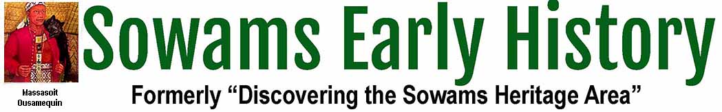

Providence Journal guest columnist John Kostrzewa wrote “The short, shaded, side spur gradually descended through an opening in the trees to a salt marsh on the shore of Church Cove. The view was spectacular. To the southwest, the Mount Hope Bridge glistened in the early-morning sun. To the south, a powerboat droned across the cove, kicking up sea spray. To the southeast, Seal Island jutted out of the water, covered with white seagulls.” Click here for the August 12, 2022 article. Click here for a map of walking trails at Mount Hope Farm.

He continues, “I found the sweeping vista while walking through Mount Hope Farm, the 127-acre property owned by the nonprofit Mount Hope Trust. The parcel of land, located on the eastern shore of Bristol, overlooks the part of Narragansett Bay known as Mount Hope Bay.”
And “Further along the road, I passed a side trail and then took the next dirt path on the right. It led me south to the banks of Church Cove, with its stunning views of the bridge, boats, the island and houses in Portsmouth across the water. Under a clear blue sky, a wisp of a salty sea breeze blew from the cove across my face. It refreshed me.”
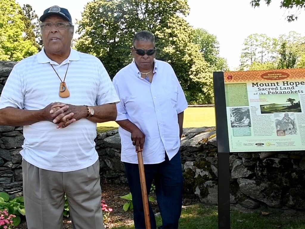
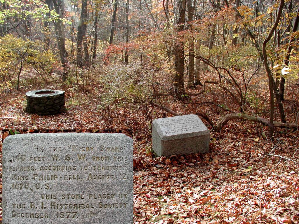
The author notes “For thousands of years, the wooded promontory was inhabited by the Pokanokets until the tribe was driven off the land by English settlers and farmers. The name ‘Mount Hope,’ which refers to a 209-foot hill and the highest point in Bristol, is derived from the Pokanoket word Montaup, which means ‘rock shore’ or ‘lookout place.'” (Above) Pokanoket Sagamore William “Winds of Thunder” Guy and Council Member Elsie “Sunflower” Morrison speak in front of a marker placed at the Farm. (Above, right) A photo shows the site where King Philip (Metacomet) was slain on August 12, 1676, thus ending King Philip’s War.