
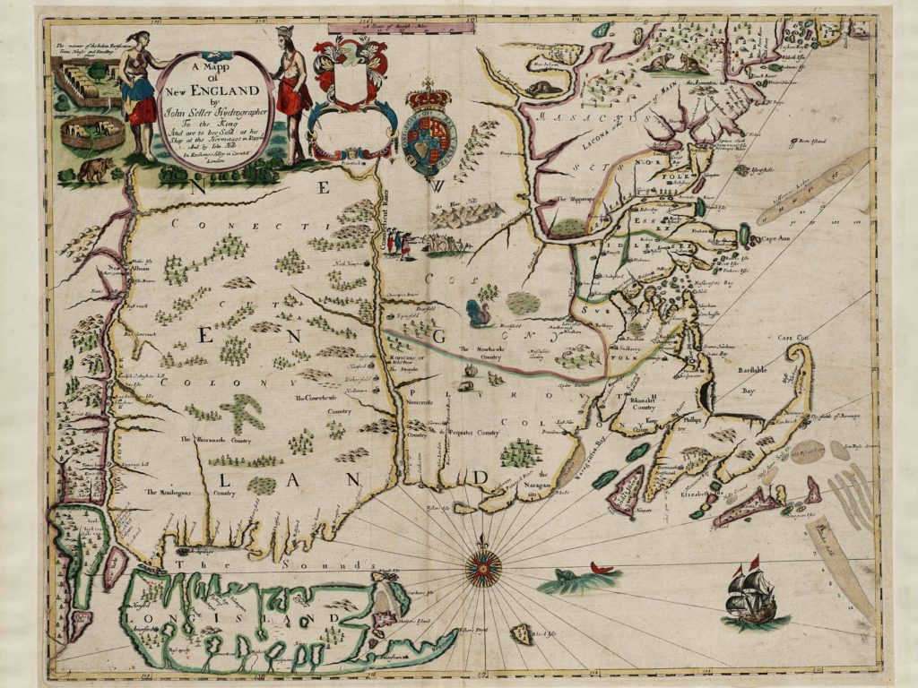
John Seller (1632–1697) was an English compiler, publisher, and seller of maps, charts, and geographical books. Click here for a ten-minute video describing his 1675 Mapp of New England, the first published in England.
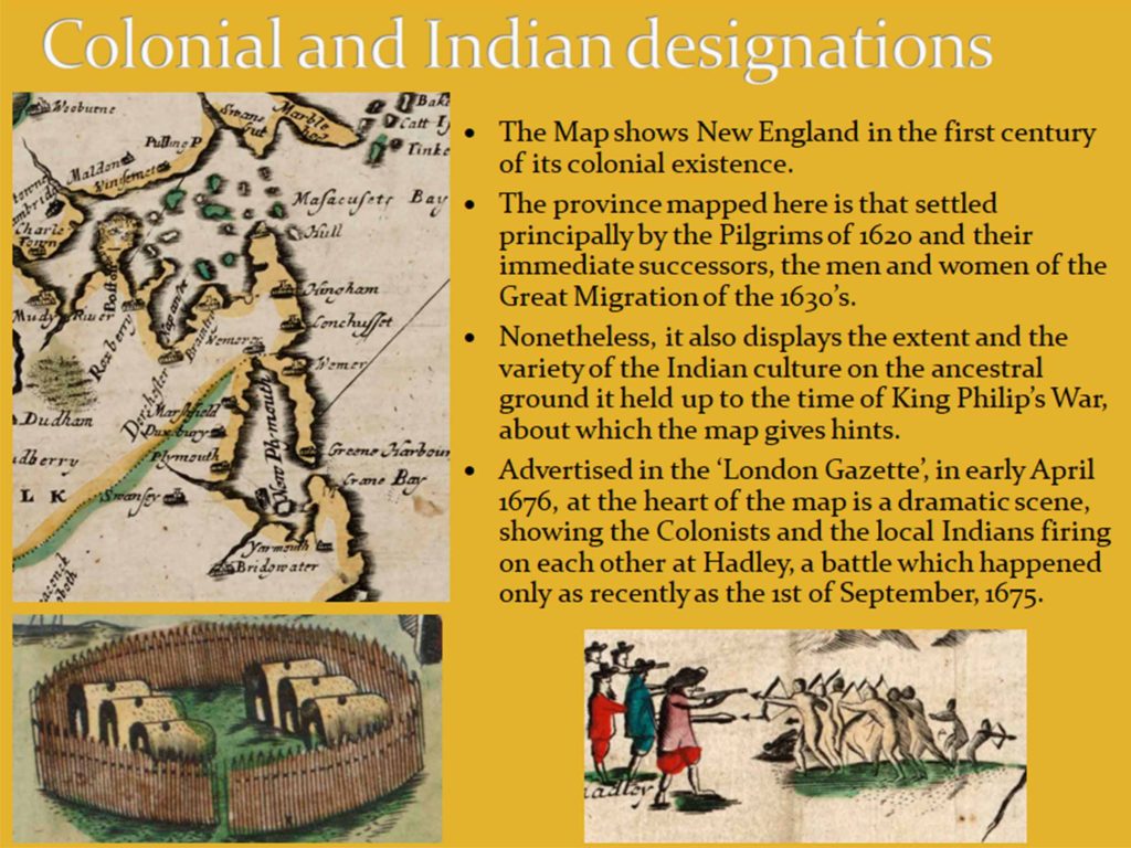
The map is neatly divided into three distinct colonies: the Connecticut Colony, the Massachusetts Colony, and the Plymouth Colony, which formed what was then known as the New England Confederation. At the heart of the map is a dramatic scene, showing the Colonists and the local Indians firing on each other at Hadley, a battle which happened only as recently as the 1st of September, 1675
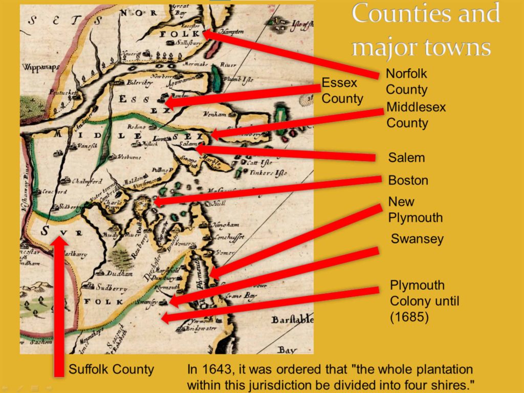
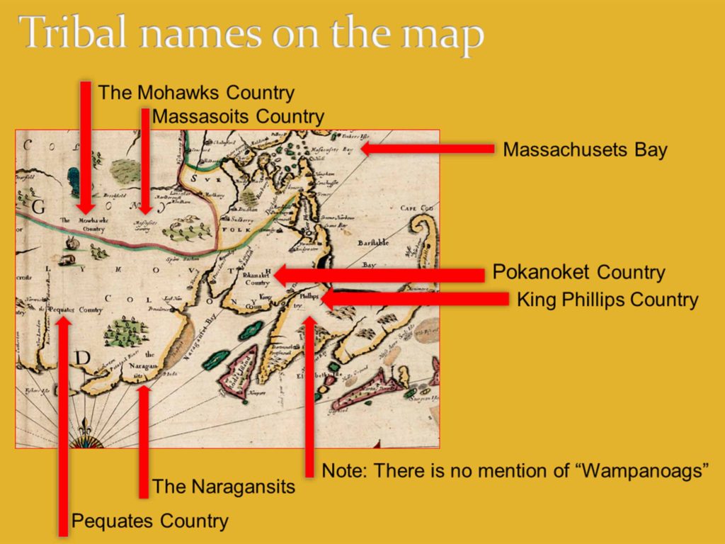
In 1643, it was ordered that “the whole plantation within this jurisdiction be divided into four shires”, and the four counties are labeled on the mapp along with a number of the towns of the time. Tribal names are also included. There is no mention of “Wampanoags” as that name did not exist at the time.
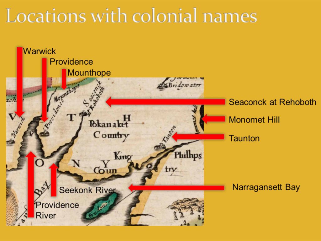
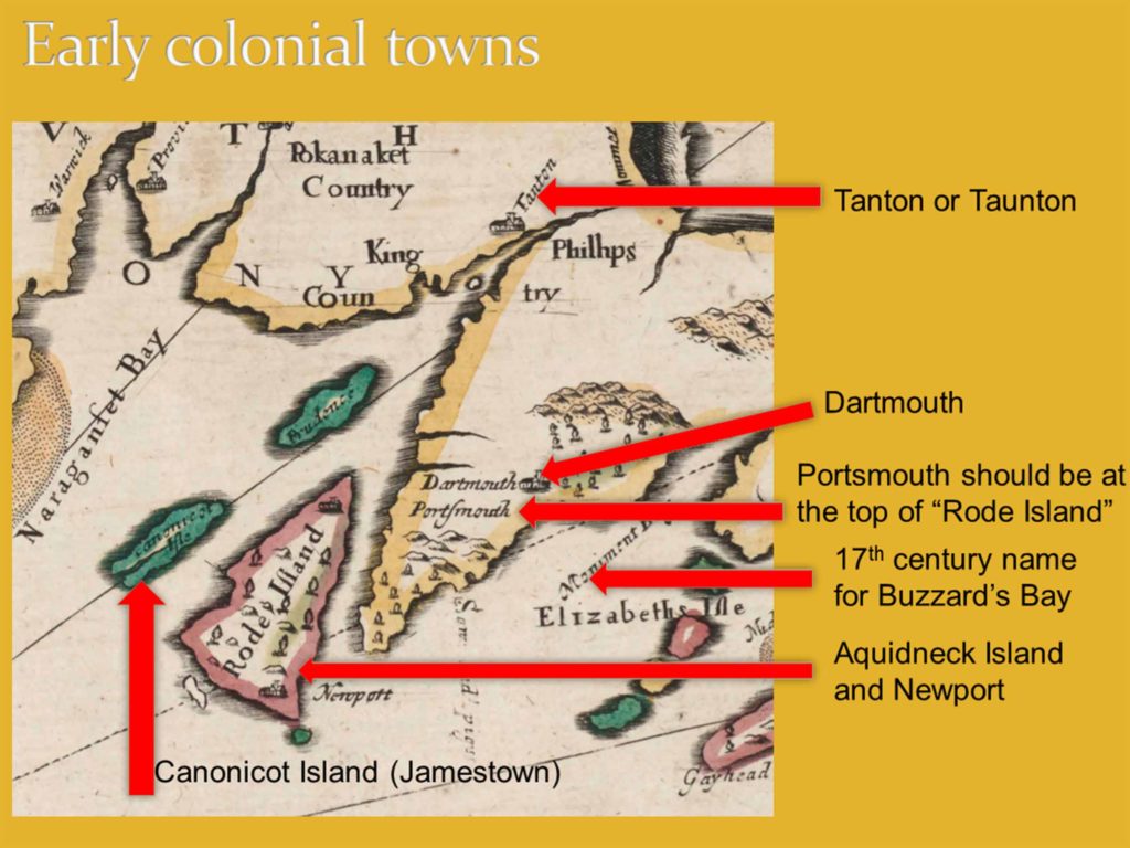
Many of the colonial names that replaced Indigenous names appear on the mapp, and English towns, many of which were burned during King Philip’s War, are indicated on the mapp.